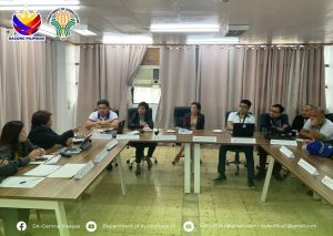
 The Department of Agriculture-Central Visayas (DA7) through the Registry System for Basic Sectors in Agriculture (RSBSA) and the Philippine Crop Insurance Corporation (PCIC7) held a meeting today (February 13, 2025), at the PCIC Office to align data gathering protocols, tools, and implementing guidelines on the georeferencing of farm parcels.
The meeting was attended by PCIC Regional Manager (RM) Paulita C. Secuya; PCIC Chief of the Management Support Division (MSD) Maria Carisa A. Adriatico ; DA7 RSBSA Action Officer for Operations Cecile A. Opada, RSBSA validators and support staff, and PCIC data processors.
During the meeting, each agency presented their data gathering protocols that were used for georeferencing of farm parcels based on the RSBSA Registration Program.
RM Secuya shared that PCIC7 is using a tablet that is equipped with digital applications to measure and locate farm parcels, which are intended for insurance coverage for rice and corn farmers. On the other hand, the DA’s RSBSA validators are using the Garmin Global Positioning System (GPS) units in georeferencing of farm lands.
The harmonization of protocols are needed to avoid data variance, and prevent duplication of fieldwork.
However, it was recommended that a study shall be conducted to analyze the data gathered by both agencies. Additionally, field georeferencers and data processors will be invited for a discussion to enhance coordination and explore the potential use of RSBSA data for PCIC’s insurance programs.
The harmonization effort will help improve data accuracy and operational efficiency, that will benefit both rice and corn farmers through a more effective insurance coverage and support services.